Day 1: Nassau to Highbourne Cay
Nautical Miles: 35
Travel Time: 5 hours
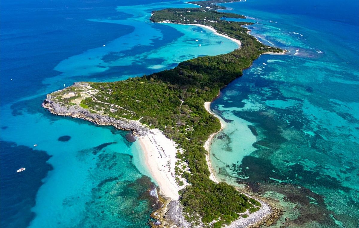
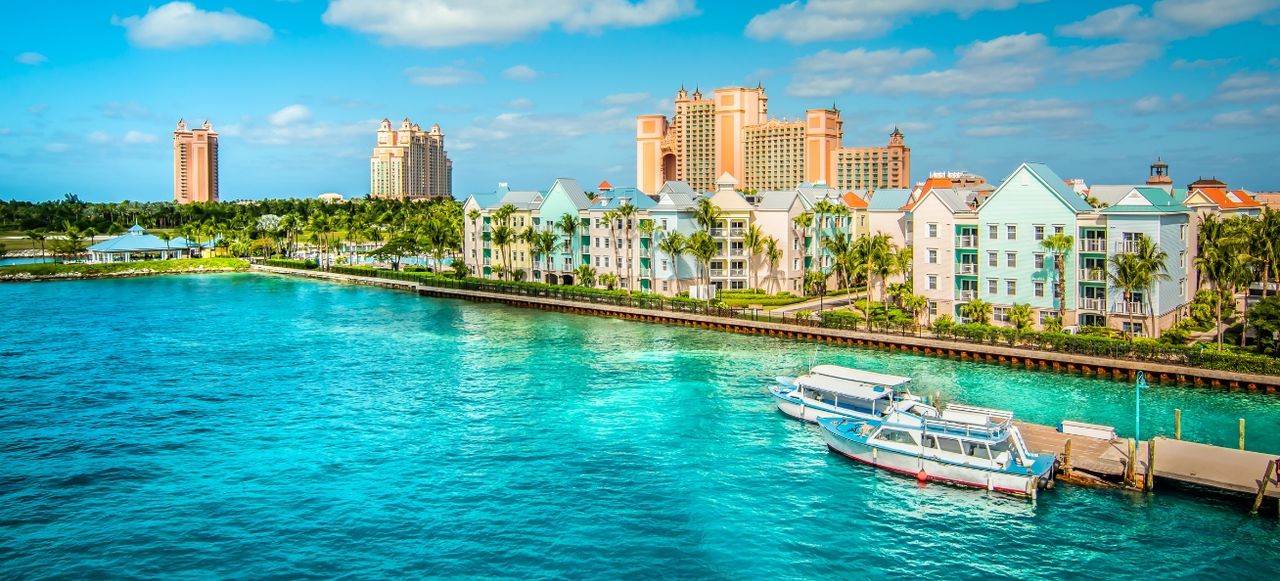
Your two-region Bahamas expedition begins in Nassau with morning provisioning and check-out from one of the capital's marinas. The bustling harbor provides a fitting departure point, with cruise ships and commercial vessels creating activity that contrasts sharply with the remote anchorages you will experience over the coming days. Depart Nassau and set course southeast toward the northern Exumas, navigating carefully across the shallow yellow banks and through the northern cays. The passage requires attention to navigation, with clear water allowing you to spot and avoid coral heads while following your plotted route toward Highbourne Cay. As you leave Nassau behind, the water clarity improves dramatically with each passing mile.
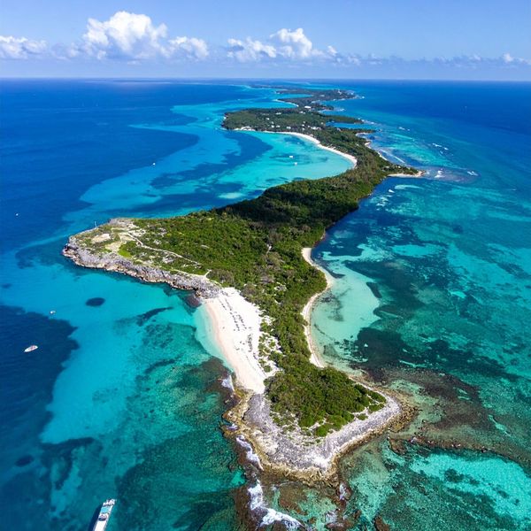
Arrive at Highbourne Cay in late afternoon and navigate into the marina basin on the western side. This private island resort serves as the gateway to the Exumas for Nassau-based charters, providing fuel, water, provisions, and resort facilities. Take a slip or mooring and spend your evening enjoying the marina restaurant, exploring the island's beaches where sting rays glide through the shallows, or simply relaxing after your first passage. The water clarity here already far exceeds anything near Nassau, providing a preview of the extraordinary visibility that defines the Exumas. The marina offers hot showers, a small store, and the opportunity to meet other cruisers heading into or returning from the island chain. As darkness falls, enjoy the peaceful atmosphere knowing tomorrow brings your entry into the famous Exuma Cays Land and Sea Park, one of the Caribbean's most successful marine conservation areas.
Route Highlights - Departing bustling Nassau and navigating southeast toward the pristine northern Exumas.
- Arriving at Highbourne Cay marina and experiencing dramatically improved water clarity.
- Swimming with sting rays off beautiful beaches and preparing for the Exumas exploration ahead.
Day 2: Highbourne Cay to Norman's Cay to Warderick Wells
Nautical Miles: 23
Travel Time: 4 hours
Depart Highbourne Cay and continue southeast down the Exuma chain, with a stop at Norman's Cay to explore the famous submerged airplane wreck before continuing to Warderick Wells. The passage takes you through brilliantly clear water with the deep blue of Exuma Sound visible to the east and shallow turquoise banks to the west. At Norman's Cay, anchor briefly to snorkel the Curtiss C-46 aircraft sitting in just 10 feet of crystal water, now functioning as an artificial reef populated by tropical fish. This surreal snorkel through a plane wreck in impossibly clear water provides one of those quintessential Exumas experiences that defines the region.
Continue southeast from Norman's Cay into the Exuma Cays Land and Sea Park, arriving at Warderick Wells by mid-afternoon. Navigate into the mooring field and take one of the available balls, checking in with park headquarters to pay the daily fee. Once settled, hike to famous Boo Boo Hill where generations of cruisers have left driftwood signs from their boats, creating a quirky monument visible from miles away. Walk the nature trails with interpretive signs explaining local ecology, or snorkel the pristine reefs along the mooring field where decades of protection have created exceptionally healthy coral and fearless fish populations. The beaches at Warderick Wells rank among the finest in the Exumas, with powder-white sand and water so clear it appears artificial. Spend your evening enjoying this protected wilderness, understanding why the Land and Sea Park is considered one of the Caribbean's most successful conservation projects and a highlight of any Exumas charter.
Route Highlights - Snorkeling the famous Norman's Cay airplane wreck in crystal-clear water.
- Entering the Exuma Cays Land and Sea Park and arriving at Warderick Wells headquarters.
- Hiking to Boo Boo Hill and snorkeling pristine protected reefs with exceptionally healthy coral.
Day 3: Warderick Wells to Staniel Cay
Nautical Miles: 12
Travel Time: 2 hours
Depart Warderick Wells and exit the southern boundary of the Land and Sea Park, heading toward Staniel Cay and the famous attractions that have made this area legendary. The passage takes you past Thunderball Grotto, the spectacular underwater cave system featured in James Bond films where shafts of sunlight penetrate through holes in the limestone ceiling. Time your arrival at the grotto carefully as it can only be entered at certain tide stages and in calm conditions. Snorkel through the caverns observing tropical fish illuminated by dramatic natural lighting, creating one of those unforgettable Exumas experiences.
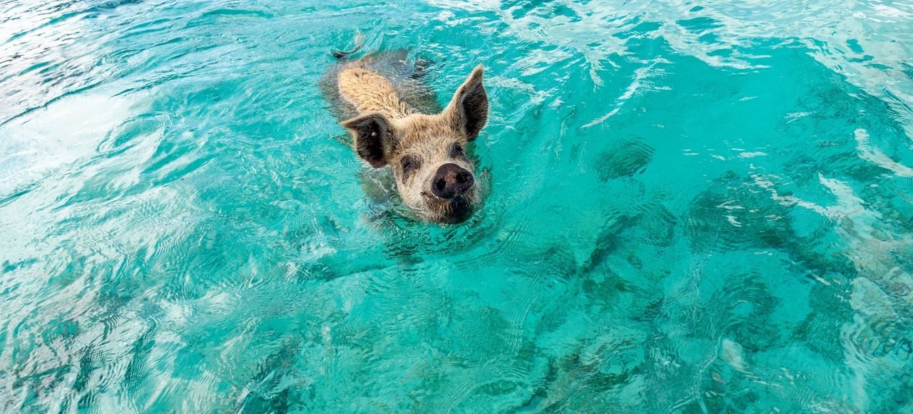
Continue to Big Major Cay for the iconic swimming pigs encounter, anchoring off the beach where these remarkable animals swim out to greet visiting boats. After your pig experience, move to nearby Staniel Cay for the night, taking a mooring or docking at the yacht club. This small settlement serves as the social hub of the central Exumas, with a marina, excellent restaurants, basic provisions, and a friendly atmosphere where cruisers gather to exchange information and stories. Spend your afternoon exploring Staniel Cay, returning to Thunderball Grotto if you missed it earlier, or simply relaxing while processing the surreal experience of swimming with pigs. Tomorrow brings your crossing to Eleuthera, so use this evening to provision for the passage and prepare for a complete change of scenery and cruising environment. Enjoy dinner at the yacht club while reflecting on three days of quintessential Exumas experiences, from pristine marine parks to famous wildlife encounters.
Route Highlights - Exploring spectacular Thunderball Grotto with its dramatic sunlight shafts and tropical fish.
- Swimming with the world-famous pigs of Big Major Cay in crystal-clear water.
- Arriving at social Staniel Cay and preparing for tomorrow's crossing to Eleuthera.
Day 4: Staniel Cay to South Eleuthera
Nautical Miles: 50
Travel Time: 7 hours
Today brings your longest passage of the week as you depart the Exumas and cross approximately 50 nautical miles of open water toward Eleuthera. Leave Staniel Cay early to allow plenty of time for the crossing, which takes you northeast across Exuma Sound toward the southern tip of this long, narrow island. The passage requires careful navigation and attention to weather, as you will be crossing exposed water between the two island groups. However, the prevailing easterly trades typically provide good sailing conditions, and the distance, while substantial, remains well within comfortable range for most charter yachts. As you progress northeast, the low profile of the Exumas gradually diminishes astern while the distinctive outline of Eleuthera emerges ahead.
Approach the southern coast of Eleuthera in the afternoon and navigate into one of the protected anchorages or marinas near Cape Eleuthera or Davis Harbour. The island presents a completely different character from the low-lying Exuma cays, with Eleuthera's narrow profile rising more prominently from the water and featuring dramatic cliffs on the exposed Atlantic side. The anchorages here provide good protection and the opportunity to provision if needed at the marina facilities. Spend your evening relaxing after the long passage, perhaps enjoying dinner at one of the resort restaurants or preparing a meal aboard while contemplating how dramatically the scenery and cruising environment have changed over the course of a single day. Tomorrow begins your exploration of Eleuthera's unique character, running the length of this 110-mile island that separates the Atlantic from the shallow Bahamian banks.
Route Highlights - Making the 50-nautical-mile crossing from the Exumas northeast to Eleuthera.
- Experiencing the dramatic change from low Exuma cays to Eleuthera's distinctive profile.
- Arriving at protected southern Eleuthera anchorages after your longest passage.
Day 5: South Eleuthera to Governor's Harbour
Nautical Miles: 30
Travel Time: 4 hours
Depart southern Eleuthera and set course northwest up the protected western shore toward Governor's Harbour, the historic capital and largest settlement on the island. The passage follows the Caribbean-style western coast with its protected beaches and turquoise water, presenting a marked contrast to the dramatic Atlantic cliffs visible on the opposite shore. Eleuthera's narrow profile means you can often see both coasts simultaneously, with the deep blue Atlantic to the east and shallow turquoise banks to the west creating striking visual contrast. The route passes several beautiful beaches and small settlements as you work your way up this long, thin island.
Navigate into Governor's Harbour and anchor in the protected bay or take a slip at one of the marinas. This charming settlement features colonial architecture dating to the 1600s, making it one of the oldest towns in the Bahamas. Pastel-colored buildings line the hillsides overlooking the harbor, with narrow lanes winding between traditional cottages. Go ashore to explore the historic churches, government buildings, and Friday night fish fry where locals and visitors gather for fresh seafood and island music. Governor's Harbour maintains excellent provisioning, with several grocery stores, restaurants, and marine supply facilities. Walk to the spectacular Atlantic-side beaches for swimming in dramatic surf, or explore the protected western beaches for calmer conditions. The town provides an authentic taste of Bahamian life beyond the tourist centers, with genuine local culture and warm hospitality. Spend your evening enjoying the town's restaurants and atmosphere while preparing for tomorrow's passage to the northern end of Eleuthera and the famous pink sands of Harbour Island.
Route Highlights - Cruising northwest up Eleuthera's protected western shore toward Governor's Harbour.
- Exploring historic colonial architecture and authentic Bahamian culture in the island's capital.
- Experiencing the dramatic contrast between Atlantic surf beaches and calm western anchorages.
Day 6: Governor's Harbour to North Eleuthera & Harbour Island
Nautical Miles: 35
Travel Time: 5 hours
Depart Governor's Harbour and continue northwest toward the northern tip of Eleuthera and nearby Harbour Island, home of the world-famous pink sand beaches. The passage takes you past the spectacular Glass Window Bridge where Eleuthera narrows to just a few dozen yards, creating a natural bridge with deep Atlantic blue on one side and shallow Bahamian turquoise on the other. This dramatic natural feature provides one of the most photographed scenes in the Bahamas. Continue around the northern tip of Eleuthera, navigating carefully through the cut that separates the main island from Harbour Island.
Navigate into Harbour Island and take a mooring or slip at one of the marinas in the protected harbour. This charming colonial village, known locally as Briland, has maintained its 18th-century character with narrow lanes lined by pastel cottages with white picket fences and flowering gardens. Golf carts serve as the primary transportation. Go ashore to explore Dunmore Town with its historic churches, boutique shops, excellent restaurants, and genuine colonial atmosphere. Walk or cart to the legendary pink sand beach on the Atlantic side, a three-mile stretch where crushed coral and shells create the distinctive rosy hue that has made this beach world-famous. The pink sand beaches of Harbour Island represent one of the Bahamas' signature attractions, combining natural beauty with convenient access and excellent facilities. Spend your afternoon swimming off the pink sands, exploring the charming village, or enjoying the upscale yet relaxed atmosphere that has made Harbour Island a favorite destination for discerning travelers. As evening approaches, dine at one of the excellent waterfront restaurants while reflecting on how your journey has taken you from the wilderness anchorages of the Exumas to this sophisticated colonial village in just three days.
Route Highlights - Passing the spectacular Glass Window Bridge with its dramatic Atlantic and Bahamian water contrast.
- Arriving at charming colonial Harbour Island and its famous pink sand beaches.
- Exploring narrow lanes, pastel cottages, and world-class beaches in this historic village.
Day 7: Harbour Island to Rose Island to Nassau
Nautical Miles: 55+
Travel Time: 8 hours
Your final day brings another long passage as you depart Harbour Island and make the run southwest across open water back toward Nassau. Leave early to allow plenty of time for this approximately 55-nautical-mile crossing. The route takes you southwest from northern Eleuthera, crossing the deep water between the islands and eventually approaching New Providence from the northeast. Consider a stop at Rose Island just east of Nassau if you want to break the passage with a final swim and beach time before entering the busy capital harbor. Rose Island offers beautiful beaches and good snorkeling, providing a peaceful transition between the remote islands and urban Nassau.
From Rose Island, make the final short leg into Nassau harbor, navigating carefully through the busy commercial and cruise ship traffic. Secure your yacht at the check-in marina and complete your formalities. Spend your final evening enjoying Nassau's restaurants and entertainment, or simply relaxing aboard while reflecting on an extraordinary week. You have covered approximately 220 nautical miles exploring two distinctly different Bahamas regions: the shallow turquoise cays of the Exumas with their famous wildlife encounters and pristine marine parks, and the dramatic landscapes of Eleuthera with its colonial heritage, pink sand beaches, and striking Atlantic coastline. The contrasts experienced over the week provide comprehensive understanding of Bahamas diversity, from swimming with pigs to walking pink sand beaches, from remote wilderness anchorages to charming colonial villages, from pristine protected reefs to dramatic ocean cliffs. This ambitious two-region expedition has revealed why the Bahamas remains one of the world's finest cruising destinations, offering infinite variety within relatively compact distances for those willing to undertake longer passages.
Route Highlights - Making the long return crossing from Harbour Island southwest toward Nassau.
- Optional stop at beautiful Rose Island for final swimming and beach time.
- Completing your 220-nautical-mile expedition through two contrasting Bahamian worlds.